Walk 1 – Whirley and Birtles

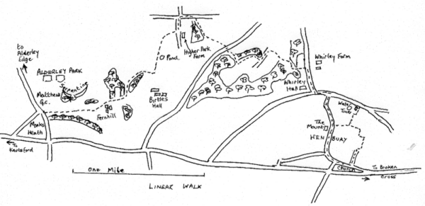
A linear walk. 4 miles, easy. 2 hours
Either westwards from the village to Monks Heath, ending at Alderley Park, AstraZeneca and telephone for a lift home, or Persuade your driver to drop you at Alderley Park (ref 844 746), and walk back to Henbury.
We describe this eastwards route. At AstraZeneca turn left towards traffic lights for 20m and turn left through gap in wall to a stile in 50m. Over the stile go straight on up the field to a stile by a post on the crest.

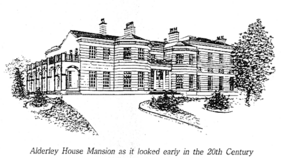
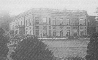
Alderley House used to be the seat of the old County family, the Stanleys. They moved there after a disastrous fire in 1799 attheir earlier home near Alderley Mill. This house too was destroyed by fire and demolished in 1933. The family then lived in their farmhouse next to the surviving tenants' hall until the estate was sold in 1938.
Straight on to stiles in "phantom fences" (views of Shuttlings Low and Sutton Common). Keep up then follow fence on left to pass to the left of Fernhill Farm by a series of stiles. Go straight on down to pass to the right of a pool in a copse and on with a fence on left to a stile, followed immediately by a second. Here go left following the field edge to the bottom left of the field where you go right for 40m to a stile by a gateway. Keep the copse on your right, then a hedge, then a fence until you reach a gate on the right leading to the imposing Birtles Hall.

This is the new Birtles Hall. The Hibbert family, after a fire partially destroyed their home at what is now called Birtles Old Hall, situated on a neighbouring site, built this large hall in 1796 on the Pasture Estate. It replaced an earlier dwelling here.
Colonel Hugh Hibbert who served in every battle in the Crmean War lived at Birtles New Hall until the late 1880's. The Hall is now divided into apartments.
Here you go left following the fence on right up field to pass a pond in a copse (Many such ponds were dug to spread marl over the fields; hence the name Marlheath Farm). Go straight on across the next field to a stile 50 m to left of lone tree. Proceed with fence now on left and over another stile in 80 m. The path now curls half right to take you up to hedge line leading to the left of Higher Park Farm to a stile by gate to the right of stables. (Here a right turn would take you to the Church at Birtles; see below). Go left up the track to pass farm cottages to a junction in 200 m. (Straight on, Slade Lane, takes you up to The Edge via path on left at top of hill: left takes you down to Bradford Lane and so on to the A34 in Nether Alderley). Go right up Hocker Lane for a little over 200 m to a well marked path on the right immediately beyond a wood. Drop with the wood on your right, through a wooded dell and up steps to a field. Go left and with fence on left (views of the Lovell radio telescope at Jodrell Bank on right) you come to a stile out to the road. This is Birtles Lane.
St Catherine's Church at Birtles is in the ecclesiastical Parish of Over Alderley, but not in our civil Parish. It was built by Thomas Hibbert of Birtles Hall after he quarrelled with the Vicar at Over Alderley.
Go right for 30 m then left along a farm access road (to Highlees Farm) for 250 m. Ignore the first unmarked stile on left. The road crosses a stream in a deep clough.
As you rise up out of the dip there is a stile high up on the left just at the end of the wood. Follow the field edge up and round to the right to a stile . Drop down left to a track and along with a clough on right (a veritable rabbit warren) to a stile by a gate in 100 m. Go right up into the field and make for the left of a pair of trees and on to a gate in the muddy patch at the right hand corner of the field. Go over the stile by the gate down a track and curl left up to a stile ahead as the track bends off to the right. Over the stile go up across the field aiming for a stile in the hedge slightly to the left of the most right of the Whirley Farm buildings. This brings you out onto Wrigley Lane. Turn right down to a junction, crossing the Henbury Parish boundary just before you reach the junction.

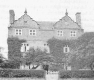
Whirley Hall is on your right. This handsome building, built in the early part of the 18th century was the residence of the Birtles and the Swettenham families. There used to be a small black and white building to one side, which was demolished before 1871, and was probably the original hall.
Go left on Whirley Lane and in 150 m turn right into Anderton's Lane (or go straight on to a path on right beyond the water tower). Continue down the lane to The Mount.
The Mount consists of a house, probably dating from the time of George III, and Mount Farm, known in 1764 as Lathams tenement. Andertons Lane was named after Samuel and his son Edward Anderton who occupied and probably built the house circa 1799.
Here you can either turn left (see below) or go straight on to Church Lane and Dark Lane, passing High Trees on your right.
Note the date plaque on the cottage which reads W.J.H. 1760. The initials probably refer to John Wainwright, chapman, who married Hannah Bibby, widow, at Prestbury in 1763. Confusingly, another cottage named High Trees lies on the corner between Andertons Lane and Dark Lane.
Church Lane on the left, and Dark Lane on the right are part of an ancient track from Broken Cross to Chelford. From the bottom end of Dark Lane, it led across open ground to join what was then the 1769 turnpike road from Broken Cross, now called Whirley Lane. It joined Whirley Lane immediately behind Pale Farm, a 14th century timber framed building. A new turnpike road, which is now the A537 was built in 1808 to replace the 1769 turnpike.
Alternatively, at The Mount, turn left down an access track. When you reach the cottages, go right to pass below them, and right at the kissing gate before the pylons which will take you behind gardens and out onto Henbury Drive and so left back to the Church and the Millennium Green. At the cottages you can instead go either left or straight on across the fields to Whirley Road.
